M3 Panoramica dei Ciabot
- Departure/arrival location: Festiona (Centro Fondo)
- Difficulty: Climb: MC Descent: BC+ Exposure: E2
- Length: 22.7 km
- Drop + : 715 m
- Departure altitude: 715 m asl.
- Maximum altitude: 1348 m asl.
- Terrain type: 60% Gravel 50% asphalt
- Type of route: Ring route, passing through Festiona, Borgata Brocci, Bergemol and Perdioni.
- Cartography: Fraternali Map 1: 25000 MTB \ E-Bike Valle Stura di Demonte
DESCRIPTION
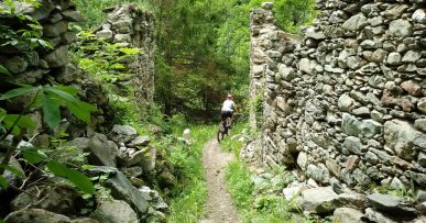
From the square in front of Centro Fondo Festiona, we continue towards the inhabited area of Festiona and continue towards Borgata Baut/Madonna del Colletto on a paved road. After four hairpin bends, there is a pine forest on the left at the end of which there is a curve to the right, after the latter, we turn right onto a paved road that will take us to Bergemolo. Continuing on this road for several kilometers, there are some fountains on the route. The route alternates asphalt and wooded gravel road. Towards Bergemolo area, at a crossroads, we turn left to climb over the houses and then descend towards Bergemolo, arriving in front of Olmo Bianco Refuge. From here we descend slightly downhill on the paved road and then turn left on the downhill gravel path. This route will take us to the town of Perdioni from where we can return to the starting site, Centro Fondo Festiona, on the asphalted road also called “Ex-Militare” road.
All the paths are frequented by hikers on foot, pay attention especially on descents: THE PEDESTRIAN ALWAYS HAS THE RIGHT OF WAY.
Download Trail: M3 Panoramica dei Ciabot (External Link)


