A28 Passo Scolettas
- Departure/arrival location: Pietraporzio
- Difficulty: Climb:OC Descent: OC+ Exposure: E3
- Length: 23 km
- Drop: 1050 mt
- Departure altitude: 1225 m asl
- Maximum altitude: 2223 m asl
- Terrain type: 50% Gravel/Military 23% Trail 27% Asphalt
- Type of route: High mountain ring route. It uses the paths: GTA (Great Crossing of the Alps) and Lou Viage. Despite the modest drop and length, the track is for very expert bikers because of the very bumpy and irregular terrain.
- Cartography: Fraternali Map 1:25000 MTB\E-Bike Valle Stura di Demonte
Description
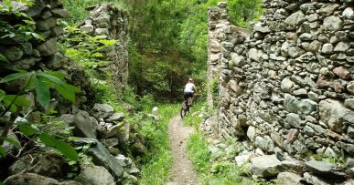
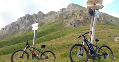
From Piazza della Chiesa in Pietraporzio on a steep asphalt route we reach the suggestive plateau “Pian della Regina”. From here we go up the Vallone del Piz on a military road with a very uneven and irregular terrain up to Passo Sottano delle Scolettas area (2223 meters above sea level), in the last part of the climb we need to move on foot because the cart track is reduced to a steep path cluttered with debris. We are on the GTA and “Lou Viage” trail. Along the way we meet a wonderful secular larch woods and we pass through a unique military tunnel having a curve. In this area we can often spot mountain goats. We begin to descend on a path that is first a meadow and then much steeper and narrow with a very irregular and bumpy terrain; at the end riders face very challenging closed and irregular hairpins to reach Prati del Vallone area with the possibility of resting at the Refuge with the same name. We cross the wonderful plateau on a gravel road and then take the paved road downhill along Vallone di Pontebernardo narrow valley. We then return on easy forest track to Pietraporzio town.


