A3 MONTE AUTES
- Departure/arrival location: Vinadio/Vinadio
- Difficulty: Climb: BC+ Descent: OC Exposure: E 3
- Drop: 1415 m.
- Length: 21.4 Km
- Departure altitude: 891 m asl
- Maximum altitude: 2286 m.
- Terrain type: 40% asphalt, 60% gravel, approx.
- Type of route: ring route passing through Podio inferiore, Neraissa inferiore, Neraissa Superiore, Castellar, Lentre.
- Cartography: Fraternali Map 1:25000 MTB \ E-Bike Valle Stura di Demonte
Description
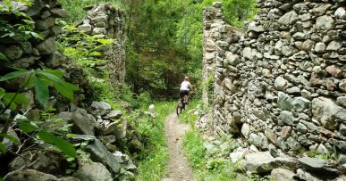
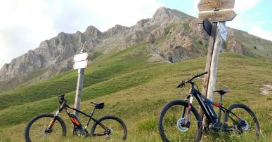
We start cycling from the square at the exit of the village of Vinadio (891 meters), on the paved road that runs alongside the Forte Albertino. The slope immediately becomes demanding up to the hamlet of Podio inferiore (1111 meters) then becomes more regular, except for short stretches, up to the hamlet of Neraissa Inferiore (1423 meters – fountain). Continue on a seemingly flat area on asphalt towards Neraissa Superiore (1519 meters – fountain). Following A3 sign, we continue on a gravel road with a slightly uneven and regular ground, with a constant slope, for about 5 km, with a beautiful panorama, which leads to Colle Neraissa hill (2018 meters). On the hill we find the remains of a large two-story barracks. Wide view of the Upper Stura Valley and Mount Nebius, a Dolomite-like mountain. On south side, a mule track with a rather rough and demanding surface, leads to Monte Autes (2286 meters). Initially the descent takes place on the wide and long grassy ridge suspended over the Stura Valley with a spectacular panorama, which then becomes very bumpy with narrow, transverse and exposed hairpin bends. An easy single track path in a beech wood takes us back to Neraissa village and another path, with a dry but regular bottom, in an almost Mediterranean environment among lavender blooms, leads to the hamlet of Lentre and than a short ride will take us back to Vinadio. Alternatively, it is possible to take a detour during the last descent: after the pylon, marked with A1b sign, a nice single enduro track that leads to Lentre. Along the route we find red marks that reflect the symbols of the signpost, i.e. the triangle with two circles, which can help you find your way.
All the paths are frequented by hikers on foot, pay attention especially on descents: THE PEDESTRIAN ALWAYS HAS THE RIGHT OF WAY.
Download Trail: A3 Monte Autes (External Link)


