A21 La Militare
- Departure location: Sambuco
- Arrival location: Argentera
- Difficulty: Climb: MC+ Descent: MC+ Exposure: E1
- Length: 24 km
- Drop + : 900 m
- Departure altitude: 1185 m asl
- Maximum quota: 1680 m asl
- Terrain type: 55% gravel 5 % trail 40% asphalt
- Type of route: Path connecting the Upper Stura Valley from Sambuco to Argentera. It touches some parts of the asphalted road that runs through the entire valley on the north side, that locals commonly call “La Militare”. It also takes place partly on gravel and passes through numerous villages and hamlets of the Upper Valley such as Pietraporzio, Murenz, Prinardo, Bersezio, Argentera.
- Cartography: Fraternali Map 1:25000 MTB \ E-Bike Valle Stura di Demonte
Description
From Piazza del Municipio in Sambuco we cycle downhill, going down through the town, we reach Strada Statale 21.We cross it, we cross the Stura river on a bridge and we move to the north side of the valley. A route begins, partly on gravel tracks with a compact and flowing terrain, partly on asphalt, first uphill and then up-and-down, which leads us to the village of Pietraporzio (1225 meters above sea level). The glimpses among the centuries-old fir trees on Sambuco are very suggestive .We then arrive seeing Pontebernardo hamlet (1280 meters above sea level) on the opposite side of the valley, and then we reach, with a very steep but short gravel road, the paved road that climbs to Borgata Murenz (1570 meters above sea level) with a woderful view on the rocky walls named “Barricate”.
Now we go down the gravel road to Frazione Prinardo (1464), we cross Rio Ferrere river on a walkway reaching the houses of Villaggio Primavera. We go up with a very steep paved route to some villas and, on a flat path with a compact terrain, we reach the town of Bersezio (1634).From here, after a short stretch of State Road 21, we cross the ski-lifts area.
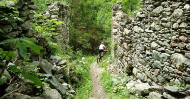
Particularly suitable for families with children who want to get familiar with gravel roads or easy paths or for those who want to ride in nature even in very hot season, since the path is shaded and without particular technical difficulties.
All the paths are frequented by hikers on foot, pay attention especially on descents: THE PEDESTRIAN ALWAYS HAS THE RIGHT OF WAY.


