A25 3 Colli
Departure/arrival location: Sambuco
Difficulty: Climb: OC Descent: OC+ Exposure: E4
Length: 35 km
Drop + :1550 m
Departure altitude: 1185 m asl
Maximum altitude: 2548 m asl
Terrain type: 45% gravel/military road 50% trail 5% asphalt
Type of route: High mountain ring route of great naturalistic and historical interest, dedicated to expert bikers. It takes place on the southern slope of the Stura Valley, crossing the slopes of Monte Bodoira with an exceptional panorama.
Cartography: Fraternali Map 1:25000 MTB \ E-Bike Valle Stura di Demonte
Description
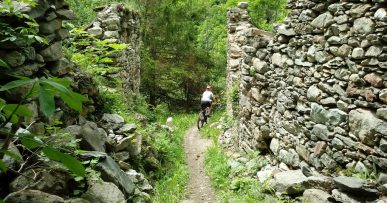
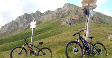
From Piazza del Municipio in Sambuco we cycle uphill taking the steep Via Moriglione. Leaving the village, we go up a steep gravel road with a fairly rough terrain to Serre Bianco hamlet and, after a short descent on a easy path, we go up on a mule track and compact gravel road to the sunny hamlet of Moriglione S.Lorenzo (1435 meters above sea level).From here we continue uphill on a cart track with moderate slopes and a fairly compact terrain up to “Pilone” (1913 meters above sea level) from where we have a nice view of Monte Bersaio and Stura Valley with the Maritime Alps in the background. We now continue the climb much more sustained slopes, which are very bumpy at times, we pass through Gias Vallonetto (2083 meters above sea level, fundamental water supply), Colle Guia and then we arrive, with some challenging hairpin bends, to Colle di Salsas Blancias (2454 meters above sea level), As soon as we descent the magnificient Rocca la Meja can be seen. Before arriving on a wide and flat military road, we take a narrow uphill mule track on the left. This makes a very airy traversing on the slopes of Mount Bodoira with fantastic views. The terrain is uneven and irregular at the limit of pedalability and the path is narrow and therefore intended for very experienced bikers. The narrow path continues up and down with a rough, uneven and inclined terrain and then crosses a much more easy meadow area to Colle della Montagnetta (2178 meters above sea level, where there are interesting remains of military bridges). From here the descent continues on a technical path, get off the bike and cross the landslide to enter the Vallone di Servagno. We continue to lose altitude on an uneven ground, we pass through the ruined village of Servagno after which we meet some demanding hairpins. We are now on the GTA (Great Crossing of the Alps) path that leads to the village of Pontebernardo (1280 meters above sea level. Here we have to cross the Stura river with its abundance of water that may create some problems).We return on forest track to Sambuco passing through the town of Pietraporzio.
All the paths are frequented by hikers on foot, pay attention especially on descents: THE PEDESTRIAN ALWAYS HAS THE RIGHT OF WAY


