A31 Rampidoc
Departure/arrival location: Bersezio
Difficulty: Climb: BC+ Descent: OC+ Exposure: E4
Length: 27 km
Drop + :1000 m
Departure altitude: 1634 m asl
Maximum altitude: 2475 m asl
Terrain type: 44% Gravel 41% Trail/Mule track 15% Asphalt
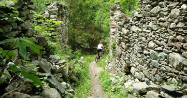
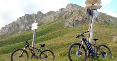
Type of route: high mountain ring route that owes its name to a MTB race that took place years ago. We partially use the trail “Lou Viage”. We pass through the narrow valleys of Ferrere and Puriac, with a small detour we can take refreshment at Becchi Rossi Refuge in the small village of Ferrere. Bear in mind that the descent on very irregular and uneven ground, sometimes highly exposed, presupposes perfect control of the bike.
Cartography: Fraternali Map 1:25000 MTB \ E-Bike Valle Stura di Demonte
Description
From Bersezio center, we go down to cross Stura River on a bridge near a playground and follow a flat path with a compact terrain until we meet an evident gravel road. We climb it with on some steep ramps and a slightly bumpy terrain intersecting a paved road with some hairpin bends in the woods and then we come out into a wonderful view of Ferrere and Forneris narrow valleys. Possibility of making a detour going down to the splendid Borgata Ferrere where we can rest at Becchi Rossi Refuge. Otherwise, we continue uphill on a slightly uneven and not steep gravel road until Gias Colombart Soprano (2252 meters above sea level).Now the climb on the mule track becomes steeper and bumpier to reach Bassa di Colombart (2457 meters above sea level).From here, a slightly irregular uphill slope with inclined bed takes us to the beginning of the long descent into the Puriac narrow valley. This starts on a meadow area with a fairly compact terrain, then we arrive at a very exposed, uneven and irregular stretch where it is recommended to go by foot. The path continues downhill on uneven terrain reaching the lower part of the narrow valley. In proximity of a small hydroelectric power station (1918 meters above sea level) we turn to the right and cross the torrent by foot, pass the short ridge that leads to a gravel road. This crosses a very large larch wood called “Bosco Bandito” on a continuous up-and-down route. With the last descent section we return to the town of Bersezio.
All the paths are frequented by hikers on foot, pay attention especially on descents: THE PEDESTRIAN ALWAYS HAS THE RIGHT OF WAY.
Download Trail: A31 Rampidoc (External Link)
Gallery


