A4 FORTE PIROAT
- Departure/arrival location: Vinadio/Vinadio
- Difficulty: Climb: MC+ Descent: BC Exposure: E2
- Drop: 538 m.
- Length: 18.8 km
- Departure altitude: 891 m asl.
- Maximum altitude: 1333 m asl.
- Terrain type: 60% asphalt, 40% gravel, approx.
- Type of route: ring route passing through Forte del Piroat, Forte Serziera, Riofreddo dam, Borgata Puà and Pratolungo.
- Cartography: Fraternali Map 1:25000 MTB\E-Bike Valle Stura di Demonte
DESCRIPTION
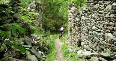
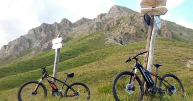
A short descent on asphalt towards Lake Vinadio and an easy and unpaved stretch lead us immediately to the beginning of the ascent on a gravel road, with a rough and uneven ground. The slope is immediately demanding, it then becomes more regular and then increases in the last stretch. The view over the town of Vinadio is beautiful. The maximum altitude is reached at the Piroat fort (1399 meters) a “defensive barracks” built between 1892-94 to protect the underlying Sarziera fort (1250 meters), that is reached after a short descent. A panoramic meadow plateau offers spectacular views of Riofreddo narrow valley and Monte Malinvern. From Sarziera fort we take a fairly smooth and narrow path that leads us to the dam (1140 meters) where we enter a paved road that leads back to Vinadio. Along the route we find red marks that reflect the symbols of the signpost, i.e. the triangle with two circles, which can help you find your way.
All the paths are frequented by hikers on foot, pay attention especially on descents: THE PEDESTRIAN ALWAYS HAS THE RIGHT OF WAY.
Download Trail: A4 Forte Piroat (External Link)


