A9 ROCCA DI SAN BERNOLFO
- Departure/arrival location: S.Bernolfo / S.Bernolfo
- Difficulty: Climb: OC Descent: EC Exposure: E4
- Drop: 998 m.
- Length: 21.2 km
- Departure altitude: 1663 m asl.
- Maximum altitude: 2575 m asl.
- Terrain type: 70 % mule track/military road 30 % trail
- Type of route: ring route passing through Laos Refuge and the lake of S. Bernolfo
- Cartography: Fraternali Map 1:25000 MTB\E-Bike Valle Stura di Demonte
DESCRIPTION
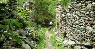
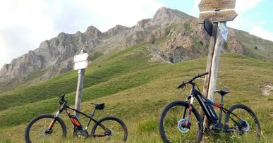
Rocca di San Bernolfo tour is a mountain cycling route. It starts from the inhabited area of S. Bernolfo (1663 meters), a characteristic alpine village, on a gravel road with a rough surface and a constant slope towards Laus Alexandris Foches Refuge, up to Làus hill, from where the lake basin of S. Bernolfo (1912 meters) opens with a splendid view on both the lake and Collalunga narrow valley. From there, a short descent lead us to the lake and starts climbing again on a rather uneven mule track to Collalunga lakes (2424 meters). We cycle around the main lake from the left and continue towards Colle di Seccia (2586 meters). The mule track descends towards the lake with the same name and skirting it on the left continues along the steep west slope of Rocca di San Bernolfo peak and, when we start climbing again, with a “portage” stretch we arrive on the hill. The panorama is magnificent and it is not unusual to find the company of mountain goats. The descent into Chiot della Roccia narrow valley is very technical with a very irregular path and strong exposure and ends on the hill above the Laos Refuge. The final stretch is done going back on the road back to San Bernolfo. Along the route we find red marks that reflect the symbols of the signpost, i.e. the triangle with two circles, which can help you find your way.
All the paths are frequented by hikers on foot, pay attention especially on descents: THE PEDESTRIAN ALWAYS HAS THE RIGHT OF WAY.


