B10 Monte Croce Enduro
- Departure/arrival location: Piano Quinto/ Piano Quinto
- Difficulty: Climb: MC, Descent: BC+ Exposure: E1
- Length: 12.6 km
- Drop: 560 m
- Departure altitude: 694 m asl.
- Maximum altitude: 1257 m asl.
- Terrain type: 50% asphalt, 50% gravel, approx.
- Type of route: ring route, passing through Beguda, Borgo San Dalmazzo and Aradolo
- Cartography: Fraternali Map 1: 25000 N.14, Bassa Valle Stura, MTB map
Description
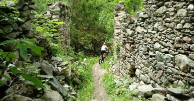
This itinerary will lead us to follow the historical trail of Saben Trail Area, the most popular and best known in the area, called Monte Croce. From Piano Quinto we go down to Borgo S.D. town on the military road and first we go up to Aradolo Sant Antonio and Tetto Pilone on asphalt and then we continue on gravel road to the square “Piazzetta degli orologi solari”, and then we reach the summit of Monte Croce on a trail. From the top of Monte Croce (about 1200 meters above sea level), we retrace our steps for a short stretch, west side, and we take the first path on the right. This is a fun trail with easy sides and jumps, medium difficulty with 2 medium-difficult passages but no particular problems. Have fun!
On request possibility to use the Bike Shuttle service.
All the paths are frequented by hikers on foot, pay attention especially on descents: THE PEDESTRIAN ALWAYS HAS THE RIGHT OF WAY.
Download Trail B10 Monte Croce Enduro (External Link)
Gallery


