M12 – MADONNA DEL PINO
- Departure/arrival location: Aisone – Aisone
- Difficulty: Climb: MC, Descent: MC, Exposure: E2
- Length: 29.2 km
- Drop: +1035 m
- Departure altitude: 810 m asl.
- Maximum altitude: 1080 m asl.
- Terrain type: 40 % asphalt, 35 % gravel, 25 % trail
- Type of route: ring-type, passing through: Paluch, Perdioni, Borgata Gena, Demonte, Barcia, Genet, Fedio, Madonna del Pino, Rifodon, S.Grato, S.Giuseppe, Aisone, Pirone, Baile, Castellar delle Vigne, Sagna, S. Defendente, Vinadio, Goletta.
Description
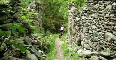
Starting from Centro Fondo Aisone, we descend the SP 337 for a few meters and then we take the road on the right that goes up to Pinet. When the slopes begin to accentuate, we turn left on a gravel road that crosses the chestnut groves until we cross the Valletta river and shortly afterwards we find ourselves on the road that leads first to Paluch and then to Signora. Then we take a gravel road on the left and then a path with a compact and easy terrain but with some small fords, some outcropping rocks that leads to Perdioni where we take the SP 337 that leads to Demonte. From here we go up the Vallone dell’Arma through some villages up to Fedio Chapel where we turn to reach Madonna del Pino (1030 meters above sea level) where we can enjoy a 360 degree panoramic view. A little further on, after a pylon, we take an old mule track with an irregular terrain that leads to Rifodon where we pass on a road that shortly after the chapel of S. Grato becomes gravel. After crossing the SS 21 with an underpass, we continue to the right on a mule track to S. Giuseppe where we take a road which, along the river, leads to Aisone. At the end of the town we start to climb crossing the SS21 to reach the Pirone with a steep climb alternating stretches of asphalt and other gravel roads. Leaving the village, we cross the valley halfway up a mule track, a technical descent near the Rio, until we reach Castellar delle Vigne. From here we quickly lose altitude on asphalt up to S. Defendente, we take the gravel road on the right, with a little rough surface, in the direction of Forte Neghino. After a few bends, take the path with an irregular terrain that goes down to Vinadio where we follow the bastion of Forte Albertino to the lake. From here, we take the gravel road first and then, crossing an iron bridge, the SP 337 road toward the village of Goletta where we go along the gravel road that runs alongside the river to return to Centro Fondo Aisone.
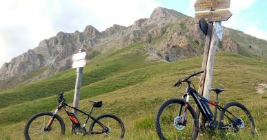
Along the route we can find red marks that reflect the symbols of the signpost, i.e. the triangle with two circles, which can help you find your way.


