M7 Colle Angelino
Departure/arrival location: Festiona (Centro Fondo)
Difficulty: Climb: MC Descent: OC Exposure: E3
Length: 27.6 km
Drop + : 980 m
Departure altitude: 715 m asl.
Maximum altitude: 1594 m asl.
Terrain type: 40% Gravel 20 % Trail 40% asphalt
Type of route: Ring route, passing through Demonte, Borgata Cornaletto Sottano, Borgata Perosa Soprana, Borgata Parafauda, Case Ronvello, Colle Angelino, Colle di Valloriate, Conaletto Sottano, Demonte.
Cartography: Fraternali Map 1: 25000 MTB \ E-Bike Valle Stura di Demonte
Description
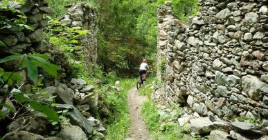
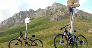
From the square in front of Centro Fondo Festiona, we take the path on the paved road called Ex Militare towards Demonte\Vinadio, at the crossroads for Demonte\Vinadio, continue towards Demonte, always going straight. At the end of the houses, continue towards Cornaletto Sottano on a gravel track and just before arriving to the hamlet we cross the paved road that will lead us to Perosa Sottana, from there, up towards Colle dell’Ortica, passed the Colle dell’Angelino, we continue to Colle dell’Ortica up to a crossroads where we take the path across to the right towards Valloriate, and the hill with the same name. After a nice stretch of road we arrive at a crossroads where we go straight to Valloriate and Tajarè trails. Then, going up to the right, we go towards Colle di Valloriate where to reach it you will need to leave the road and climb for a few meters on a path up to then going downhill. Here we are at Colle di Valloriate from where we will descend on a VERY TECHNICAL path that will quickly lower us in altitude arriving near Borgata Cornaletto Sottano. From here on a gravel road we arrive in Demonte, and at Caseificio Valle Stura dairy where we take the return way on “Ex-Militare” road to Festiona, Centro Fondo.
Alternatively, the route can be started and ended in Demonte, starting from in front the Tourist Office, following the signs for Perosa Sottana, and at the way back, when we arrive at Caseificio Valle Stura dairy we can return to Demonte village by the main road or by secondary roads along the Kant river, cycling alongside the Sports Hall to reach Piazza Renzo Spada.
All the paths are frequented by hikers on foot, pay attention especially on descents: THE PEDESTRIAN ALWAYS HAS THE RIGHT OF WAY.


